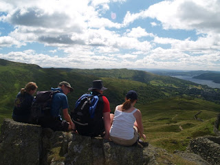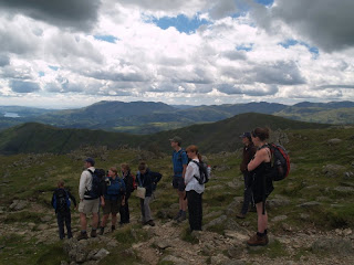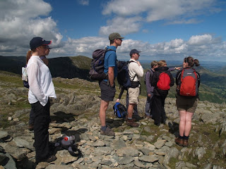


We're a walking group in the Lake District aimed at younger walkers in their 20s 30s and 40s. Whether you're an experienced mountain walker or a complete novice - this is the friendly walking group for you! summittgoodrambling@gmail.com
Friday 27st July and every last Friday of the month
Meet at the brewery arts centre, vats bar in Kendal
From 8pm
A chance for new members to meet existing members
If you are new and don't know anybody in the group call me first
Start Point:
Car Park near to Dalegarth Hall in the Eskdale Valley (G.R. NY 171003) @ 10.00
(reached by turning right [when travelling East up Eskdale] onto the small lane just before the end of the L'all Ratty tracks & Boot village)
Description: From the car park we head South up onto Birker Fell (just 190m-or-so of climbing). After we cross the Birker Fell lane, and pass Devoke Water, it's about 3 miles of gentle downhill towards the coast. Once down we follow the A595 (unfortunately necessary) for just about ½ a mile, before turning back up Eskdale again. Then, rather than just following the bridleway along the valley bottom, we bear off a bit to ascend Muncaster Fell (just 210m high). We then get a very gentle 'ridge run', before popping out at Eskdale Green (re-hydration / food at the King George IV??). From there it's only about a mile and three-quarters, alongside the river, back to the car park.
Total Ascent: 445 metres (1460 ft.)
Time: 7 hours
Grade: 3
Car Share: Meet at the Low Wood Hotel @ 09.00
Leader: Dan (on 01229 832840 [eves.] or 07919 831237)
Walk for July 15
Winster Valley
Length approx 7.5 miles (easy walk, little ascent)
Start: Lay-by next to Ghyll Head Reservoir, (GR399925) 11.00
Or meet at Morrisons, Kendal at 10.40 am to car share.
Leader: Lucy (Tel: 01539 739951 or 07929125587)
Beautiful varied walk through woods and pasture land past several small tarns and with views across Windermere and the added attraction of a stop at the Brown Horse pub half way. Although only a mile or so from Bowness, this is a quiet, unspoilt area of enormous charm. Follows good paths or lanes almost all the way.
Sunday 8th July 2007,
Helvellyn and
Start : 9.00 a.m. at Wythburn church car park
Car share Low Wood at 8.15 A M
Walk finishes at Rydal Mount so some cars to be left there en route. More details of GR and length/ascent to follow.
Walk Leader Simon: 07791 006 232Arthur's Pike and Loadpot Hill
This relatively leisurely walk takes in some sites of historic interest, including standing stones, shake holes and stone circles. Although this walk is not technically difficult and has no steep ascents, it is relatively long (12 miles, taking 6+ hours incl. rest stops)
On a clear day, we should get some great panoramic views of the Pennines, Blencathra and the eastern
From Heltonhead, the route takes us first to Moor Divock and The Cockpit (an ancient stone circle). From there, we have a gentle ascent of White Knott, Barton Fell, Arthur's Pike (1,747 ft), the two "pillars" of Bonscale Pike (1,718 ft), and from there onto
Distance: Approx. 10 miles
Ascent: Approx. 1,800 ft
Time: Approx. 6 hours
Starting point: just beyond Heltonhead SW of Askham, GR 503218 (Follow the steep road running up from Helton onto the moor).
Start time: 10.00 AM
For car sharing, meet at Morrison's car park (Kendal) at 09:00.
Leader Anne 077 299 03 852
Sunday 3rd June
Dovedale, Dove Crag, Hart Crag, Fairfield, Hartsop above How.
Starting from Cow Bridge nr Hartsop, Ullswater - past Brother’s Water and up Dovedale with a steep ascent onto Dove Crag (792m). Up again to Hart Crag (822m) and along Link Hause with a gentle climb onto Fairfield (873m). Follow the path back onto Hart Crag and then wind back down Hartsop above How, with a little bit of a steep descent at the end back to Cow Bridge.
Distance: Approx 7.5 miles
Time: 5 hours
High Point : Fairfield (873m)
Ascent: Approx 700 m
Grade: 3
Start: 10.00, .Cow Bridge Car Park, nr Hartsop (Patterdale, Ullswater) GR 402133
Car Share: Meet at the Low Wood Hotel @ 09.00
Leader: Sam (07890961482) Eve – 01228 631 416Start Point: in Ambleside (beside the River Rothay / opposite the park / by the footbridge)
(G.R. NY - 371044 @ 10.00)
Description: After walking through the park & Ambleside centre (food re-supply possible?) we head East, up beside Stock Ghyll (& look at Stock Ghyll Force?). After crossing the Ghyll we'll end up heading N., crossing Snarker Moss, to reach the top of Red Screes. We then descend via
Distance: 9.25 miles (14.9 km)
Total Ascent: 725 metres (2380 ft.)
Time: 5 / 6 hours
Grade: 3
Car Share: Meet at the Low Wood Hotel @ 09.30
Leader: Dan (on 01229 832840 [eves.] or 07919 831237)
Start Point:
Main Tilberthwaite car park, by the bridge over Yewdale Beck (G.R. NY 306010) @ 10.00
Description:
First we climb up beside Yewdale Beck & Tilberthwaite Gill, past the mine workings, along Wetherlam Edge and up to the top of Wetherlam (762m). Next we head WSW along Prison Band to Swirl How (802m), before turning N to pass Great Carrs. We'll then descend via Wet Side Edge into the Greenburn Valley, to follow Greenburn itself down into the Little Langdale Valley. After that we'll pass above Atkinson Coppice and pass Knotts, before dropping down to High Tilberthwaite Farm. From there it's only about ¼ of a mile, along the lane, back to the car park.
Total Ascent: 720 metres (2362 ft.)
Highest Point: Swirl How (802m / 2631ft.)
Time: 5 / 6 hours
Grade: 3
Car Share: Meet at the Low Wood Hotel at 09.30
Leader: Dan (on 01229 832840 [eves.] or 07919 831237)
Sunday 6th May
Around Loughrigg
6 Miles
3 Hours
244 Metres Ascent
Grade 2
Start 11.00 Carpark At Elterwater Common Gr 330050
Car Share 10 .30 Low Wood Hotel Near Ambleside
A Leisurley Ramble Around Loughrigg,
Leader Becky 077 68 480 454
Meet St Peter's church in Martindale at 9am, Grid Ref 436192. (grade 4) Walk is 18km over hilly terrain with a
Please call Jane on 07733 228202 before the day if interested.
Date: Sunday 22 April
Location: Cross Fell - The highest point in the
Route: Past Kirkland Hall, then up the old corpse road to Garrigill, then along the
Distance: Approx 10 miles
Time: 5.5-6.5 hours
Ascent: Approx 700 m
Grade: 3-4
Start: 1030,
the church, Grid Ref NY645325.
http://www.streetmap.co.uk/newmap.srf?x=364550&y=532550&z=3&sv=364550,52550&st=4&mapp=newmap.srf&searchp=newsearch.srf&ax=364550&ay=532550
Car share: 0915, Morrisons (Kendal)
Leader: Tom 07884493081 or 01228550307
Start Point: Three Shire Stone (on the top of
(G.R. - NY 277027 @ 11.00)
Description: This walk starts from The Three Shire Stone (which is already at 393m) and heads in a NNW direction, before passing Red Tarn and then Great Knott. While easily climbing we should look back for cracking views of Pint of Bisto, Coniston Old Man & (eventually) Windermere. We then carry on to the Crincles (where, from the '2nd one', there are great views N to Skiddaw, Blencathra & Helvellyn) and then carry on to Bowfell (for yet more watery views of Windermere, Esthwaite Water & Devoke Water!). From Bowfell we'll retrace our steps back to Three Tarns and then bear to the right of the Crincles to reach the top of Cold Pike (after a couple of miles). It's then only about a mile straight back to the Three Shire Stone or (if it's boggy) we can cut back to the path we started on, to return to the cars.
Distance: 7 miles (11.3 km)
Total Ascent: 610 metres (2000 ft.)
Time: 4.5 hours
Grade: 3
Car Share: Meet at the Low Wood Hotel @ 10.00
Leader: Dan (on 01229 832840 [eves.] or 07919 831237)
Fiona has currently booked (provisionally) 8 tent spaces at the Old Post Office Campsite at
Would interested parties also like to state what they would particularly like to do whilst in the Wasdale area, and whether they are happy to lead a walk.
James and I have one 2/3 man tent which can be borrowed if anyone needs a tent.
Rob has got 2 group 2 man tents for hire if any body needs them too.
Fiona
MESSAGE FROM PAUL B
I'm thinking of doing a wild camp around Easter to tie in with the weekend Fiona is sorting out. I was thinking of Thursday night or Monday night. I am hoping to do more of that this year. IS anyone else is interested in that sort of thing?
Blencathra (868m) via hall's fell ridge
09.00 am meet at the low wood hotel, Ambleside for car share
10.00 am start : GR 318 256 Threlkeld village small carpark past the two pubs then turn right.
Grade 3/4
Option to do a grade 1 scramble on sharp edge
750 metres of ascent
6 hours
Hall's fell ridge is in itself an easy scramble, it is above high steep slopes, it should not cause any problems if you are a competent hill walker.
Leader: Rob 0777 398 6512
Friday 31st March and every last Friday of the month
Meet at the brewery arts centre, vats bar in Kendal
From 8pm, this is now a no smoking bar
A chance for new members to meet existing members
If you are new and don't know anybody in the group call me first
Rob 0777 398 6512
SUNDAY 25TH MARCH
Catbells & Borrowdale - I like to do this walk at least once a year - Good views but without too much hard work! May get some snow left over!
Leader James Richardson: (0777) 9936378
Start: 08:45 Morrisons Kendal or
10.00 at walk start: NY 247 212 - Take A66 West and take first left passed Keswick towards Portinscale, through village and bear left (not taking Ullock road) left again and park before cattle grid - again recommend car share as not a lot of space.
Difficulty: Around 3.
Starting bellow North end of Catbells following the ridge to Maiden Moor and High Spy. Down into Borrowdale to range (cup of tea/ice-cream if open) and back along the lake side.
Approx. 11 k
Sunday 18th March
Skiddaw via Longside Edge
For those who aren’t doing their Mother’s Day duty, this is a stunning walk up the 4th highest peak in
Distance: 6.5 miles
Time: 4 – 5 hours
Ascent: 800 metres!
Grade 3
Start: 10:30am @ the wee layby on the Orthwaite road 500 metres north of the junction with A591. Grid ref NY 237 311
Car Share: 9:30am @ Low Wood Hotel
Leader: Jeremy 07899 923019
Wansfell Pike / Woundale / Red Screes
Start Point: in Ambleside (beside the River Rothay / opposite the park / by the footbridge)
(G.R. NY - 371044 @ 09.30)
Description: After walking through the park & Ambleside centre (food re-supply possible?) we head E, up beside Stock Ghyll (& look at Stock Ghyll Force). After crossing the Ghyll (twice) we'll end up heading up Wansfell Pike, before turning NE'ish to follow the wall along the ridge. Once we reach the A592, we turn right & do about 450m on the road, & then left, to carry on up to St. Raven's Edge. We then descend down to
Distance: 9.75 miles (14.9 km)
Total Ascent: 1000 metres (3281 ft.)
Time: 7 hours
Grade: 3 / 4
Car Share: Meet at the Low Wood Hotel @ 09.00
Leader: Dan (on 01229 832840 [eves.] or 07919 831237)
Grizedale and Deepdale
Moderate - hard, about 16km, 3000ft ascent
Flat walk up Grizedale leads us to the east ridge of Nethermost, a steep ascent of which gives access to the Helvellyn ridge (we will visit the summit time allowing). South over Dollywaggon to Grizedale tarn then a short climb to Deepdale Hause leads to a long decsent through Deepdale.
Starting point is the car park at the George Starkey Hut in Patterdale (grid ref 397160), on the right as you drive north through the village.
Some very mild scrambling, but no major difficulty. I am a slow walker so the pace will be easy for anyone to keep up with. We will be out high, so please come prepared with full waterproofs and warm clothes. NO JEANS AND PLEASE BRING A TORCH.
Grade: 4
Meeting time: 8.30 AT THE LOWWOOD HOTEL
These are the walk details for 18th feb.
Starting at The High Cross Inn, Broughton in
The walk itself is very easy but taking in some lovely views of the Duddon. I decided to start from the pub as parking spaces are limited up on Corney fell.
We will be walking for a couple of hours with lunch along the way so better make that three
Please contact Rachel for more information if required, also to let her know if you will be going,
Walk up Bow Fell (904m) from Langdale via Mickledon Beck, Rossett Gill and
Angle Tarn. Descend via Hell Gill and Whorneyside Force.
Start: Old Dungeon Gill Hotel Car Park GR285061 at 10am
Car Share: Low Wood Hotel near Ambleside at 9.30am
Time 5-6 hours
Leader Barbera 07843 567 097
SuMMitt Good planning meeting (bring a pudding) to be held at James and Fiona’s in Kendal. Everybody welcome from 7.30 pm on Saturday 3rd February
This meeting is to plan future walks from march to august 2007
If you cannot make this meeting and would like to lead a walk then contact me with some dates and a brief walk description so i can put you down at the meeting for that walk.
If you are new or not confident to lead a walk, please forward some ideas for walks you would like somebody else to lead on your behalf.
We will also try to resolve the problem with the website.
For address in Kendal contact James or Fiona on 01539 73 14 81
Please make an effort to attend.
Description: An easy level walk over pastures, marshland, shore paths and tow paths. From Carnforth we walk to Morecambe Bay Nature Reserve, then into Hest Bank, returning along the
Start: 11 AM GR 492696 Landranger 97, In layby 1 mile south of carnforth on canal side of A6
Distance: 6 miles
Time: 3 hours
Grade : 1
Leader: Becky 0777 398 6512 or 01539 444156