
Sunday, 17 February 2008
Sunday, 10 February 2008
Walk for Sunday 10th February - Hawes
Walk for Sunday 10th February 2008
Start: 10:30 Hawes large car park at the National Trust Visitor Centre.
Distance: 7 – 8 miles.
Time: 4 hours walking.
Fairly easy walk which starts at the upper end of Hawes following a river path. We then have a bit of a climb to Hardraw Force and then to the pretty Hamlet of Sedbusk. The route continues to reach the river again and finish up in Hawes for tea and cake or whatever you might fancy. Sorry I can’t give you more details, I have done part of the walk so can describe that but not the other part. Should be a fairly easy walk but bring all appropriate gear as normal. Hope to see lots of you there and hope the location doesn’t put you off.
Leader: Clare
Mobile: 07729021534
Home: 01748 812210
IF ANY BODY WANTS TO MEET IN KENDAL CAR SHARE WILL BE AT MORRISONS CARPARK LEFT HAND SIDE AT 9.00AM
I WILL BE THERE, ROB
Sunday, 3 February 2008
Walk for Sunday 3rd February - Loughrigg
Loughrigg Fell & Tarn
Sunday 3rd Feb.
Start Point: Roadside parking beside the River Rothay / Rothay Park, Ambleside
(G.R. NY 371044 @ 10.20)
Description: We'll walk, from beside the Rothay, up, past Lily Tarn, onto the S end of Loughrigg Fell. After reaching the trig. point at the summit (335m), we'll descend (beside a wall) to the lane at the 'back' of Red Bank. After turning L, we follow the lane only for 250m'ish to a footpath on the L. We follow that around the N side of Loughrigg Tarn to a path / b-way jcn. We turn L then follow the b-way all the way back to the lane beside the Rothay.
Distance: 5 miles (8 km)
Total Ascent: 425 metres (1395 ft.)
High Point: Loughrigg Fell - 335 metres (1100 ft.)
Time: 4 hours
Grade: 2
Car Share: Meet at the Low Wood Hotel @ 10.00
Leader: Dan (on 01229 832840 [eves.] or 07919 831237)
Sunday, 27 January 2008
Walk for Sunday 27th January - Barbon and Casterton Fells
Barbon and Casterton Fells
Not Strictly in the Dales National Park but pretty much on the edge,this walk takes in some of the lesser known fells to the south of theHowgills. Nothing too challenging, but if the weather is good and thereis time the walk can take in a bit of extra height so as to admire theview across the Lune valley. Starting at Barbon Church and heading upBarbondale, then over towards Bullpot Farm, a centre for caving, down tothe small limestone "gorge" of Easegill Kirk and then possibly a look atsome Andy Goldsworthy "sheepfolds" or a small stone circle.
Car Share : Morrisons, Kendal 9.00am
Walk start : Barbon Church 9.45, on-road parking G.R. SD630 825(Explorer OL2 - Y.Dales south and west) There is also a large layby asyou turn into Barbon off the main roadjust before the bridge.
Grade : 2/3. Apart from a few bits of steepish gradient nothing tootaxing - probably be boggy in parts after all the rain.
Length : Approx 8 miles
Time : 5/6
Leader : Alister 0776 1433 437
Sunday, 20 January 2008
Walk for Sunday the 20th January - Easedale
Sunday 20th January
Walk up Easedale from Grasmere,maybe going via Helm Crag, depending on the weather and snow line (Grade 2/3).
If poor weather, alternative low level walk will be arranged on the day starting from Grasmere, probably the old coffin route to Ambleside, and then back again alongside Rydal water (Grade 1).
Remember to bring plenty of warm clothes (hat, gloves etc), waterproofs, a packed lunch and a camera.
We will probably go to a local pub or Grasmere Garden Centre for refreshments after the walk.
Meet at Low Wood Hotel car park at 9.30am for car share.
Alternatively meet at Grasmere National Park car park at 10am. Free parking is available in the school playground, or on the road near the church (although it is a Sunday, so likely to be full). The National Park car park will be empty, although it is quite expensive.
Length approximately 7 miles
Total ascent approximately 600m
Duration approximately 5-6 hours
Please contact Kate on 07970 665554 if you would like to come.
Sunday, 13 January 2008


Walk for Sunday the 13th January - Lingmoor
Dow Bank & Lingmoor, Langdale
A walk up past Megs Gill waterfall, on the northern fells of Great Langdale, a return to the valley bottom to reach Side Pike, and then through The Squeeze and a mild scramble over Lingmoor Fell to return to Elterwater.
Car Share: 9:30am Low Wood Hotel
Start: 10:00am @ free car park on the edge of Elterwater village NY 330 051
Grade: 3
Distance: 7 miles
Time: about 5 hours
Contact: Jeremy 07899 923019
Sunday, 6 January 2008
Walk for Sunday the 6th January - Dow Crag
Sunday 6th January
Ascent of Coniston Old Man
The route will be dependant upon weather conditions, but may include a scramble and also a chance to explore an old copper mine, so bring a torch.
Car Share: 9:15am Low Wood Hotel
Start: 10:00am @ Walna Scar Car Park, Coniston NGR: SD 289 971
Grade: 2-3
Time: about 5 hours
Contact: Barbs 07843 567097
Sunday, 30 December 2007
Walk for Sunday 30th December - LOW LEVEL WALK FROM ELTERWATER
A LOW LEVEL WALK FROM ELTERWATER
PARK IN FREE CARPARK BY ELTERWATER VILLAGE (ON ROAD TO LANGDALES)
AT 11 AM
OR MEET AT THE LOW WOOD HOTEL AT 10 30
DURATION 3 HOURS
DISTANCE 6 MILES
LEVEL EASY
LEADER ROB 0777 398 6512
PARK IN FREE CARPARK BY ELTERWATER VILLAGE (ON ROAD TO LANGDALES)
AT 11 AM
OR MEET AT THE LOW WOOD HOTEL AT 10 30
DURATION 3 HOURS
DISTANCE 6 MILES
LEVEL EASY
LEADER ROB 0777 398 6512
Sunday, 23 December 2007
Walk for Sunday 23rd Decemeber - Wander above Windermere
Wander above Windermere
Start Point: Windermere train station car park (££ if you park there!)
(G.R.- SD 414986 @ 10.00am)
Description: A gentle saunter up Orrest Head, the Dubbs Road, Longmire Road, Far Orrest & Elleray Bank.
Distance: 7.25 miles (11.7 km)
Total Ascent: 281 metres (919 ft.)
Time: 3 - 4 hours
Grade: 2
Car Share: Meet at the Low Wood Hotel @ 940am
Leader: Dan (on 01229 832840 [eves.] or 07919 831237)
Sunday, 16 December 2007
Walk for Sunday 16th December - Coniston Village and Water
Walk for Sunday 16th December
Grade 1 easy
Distance 6 miles
Time 3 to 4 hours
Meet at Low Wood Hotel at 10.30 am
Start point 11 am Coniston GR 287 946 in large layby east side of road north of the bridge over Torver beck.
Good paths, tracks and a little road walking - just right for a winters day.
From the start we walk past Hoathwaite farm to Coniston water passing Coniston hall with its magnificent chimneys, built in 1270 by the Fleming family
Next we reach Coniston village for refreshments and lunch
Then return back to the start
Leader EMMA 0777 320 2845
Sunday, 9 December 2007
Walk for Sunday 9th December - Hangover Walk
SUNDAY 9TH DECEMBER
HANGOVER WALK
LEADER JANE T 07733 228 202
Saturday, 8 December 2007
Christmas Meal Saturday 8th December

Saturday 8th December
SUMMITT GOOD CHRISTMAS MEAL
SUMMITT GOOD CHRISTMAS MEAL
The Joshua Tree
Stramongate
Kendal
(0791495551)
Stramongate
Kendal
(0791495551)
please let Alastair H know if you would like to come along
07791 801 597
Alastair@alastairhartley.orangehome.co.uk

(Beware of the hand!)
07791 801 597
Alastair@alastairhartley.orangehome.co.uk
(Beware of the hand!)
Monday, 3 December 2007


Sunday, 2 December 2007
Walk for Sunday 2nd December - Birkrigg Common & Furness Stroll
Start Point: Parking spaces between 'coast road' (A5087 - signed from Ulverston as 'Barrow via Coastal Route') & edge of Morecambe Bay's beach (G.R. - SD 301 742 @ 11.00)
Description: follow beach (nr. Bardsea) / Sea Wood / Birkrigg Common / Sunbrick / Holme Bank / Great Urswick (poss. drink stop at the General Burgoyne pub?) / past Woodside Farm / Far Mount Barrow / N. side of Birkrigg Common / Bardsea Green & back to cars.
Distance: 8 miles ( 12.9 km)
Total Ascent: 176 metres (577 ft.)
High Point: Birkrigg Common - 136 metres (446 ft.)
Time: 4 hours
Grade: 2
Car Share: Meet at the Low Wood Hotel @ 10.15 (without 'leader'! - will meet @ start)
Saturday, 1 December 2007
Pudding and Planning Party Saturday 1st December
SATURDAY 1ST DECEMBER 7 PM
PUDDING AND PLANNING PARTY AT ROB AND BECKYS IN WINDERMERE
THE NEXT PLANNING AND PUDDING MEETING IS ON SATURDAY 1ST DECEMBER AT ROB & BECKY'S AT 7.30 PM TO DISCUSS FUTURE WALKS TO THE END OF MARCH 2008 OR BEYOND. PLEASE BRING WITH YOU A NICE PUD AND A LIST OF WALKS AND DATES YOU WOULD LIKE TO LEAD.
IF YOU ARE NEW TO THE GROUP YOU CAN COME ALONG ALSO WITH ANY SUGGESTIONS, EVERY ONE WELCOME, IF YOU CANNOT ATTEND BUT WOULD LIKE TO LEAD A WALK OR SUGGEST A WALK FOR SOMEONE TO LEAD THEN EMAIL ME WITH DETAILS BEFORE THE MEETING.
REGARDS ROB 0777 398 6512
Sunday, 25 November 2007
Walk for Sunday 25th November - Beda Fell, Place Fell and Angle Tarn Pikes
25TH NOVEMBER
BEDA FELL, PLACE FELL AND ANGLE TARN PIKES
LEADER ANNE 07729 903 852
Sunday, 18 November 2007
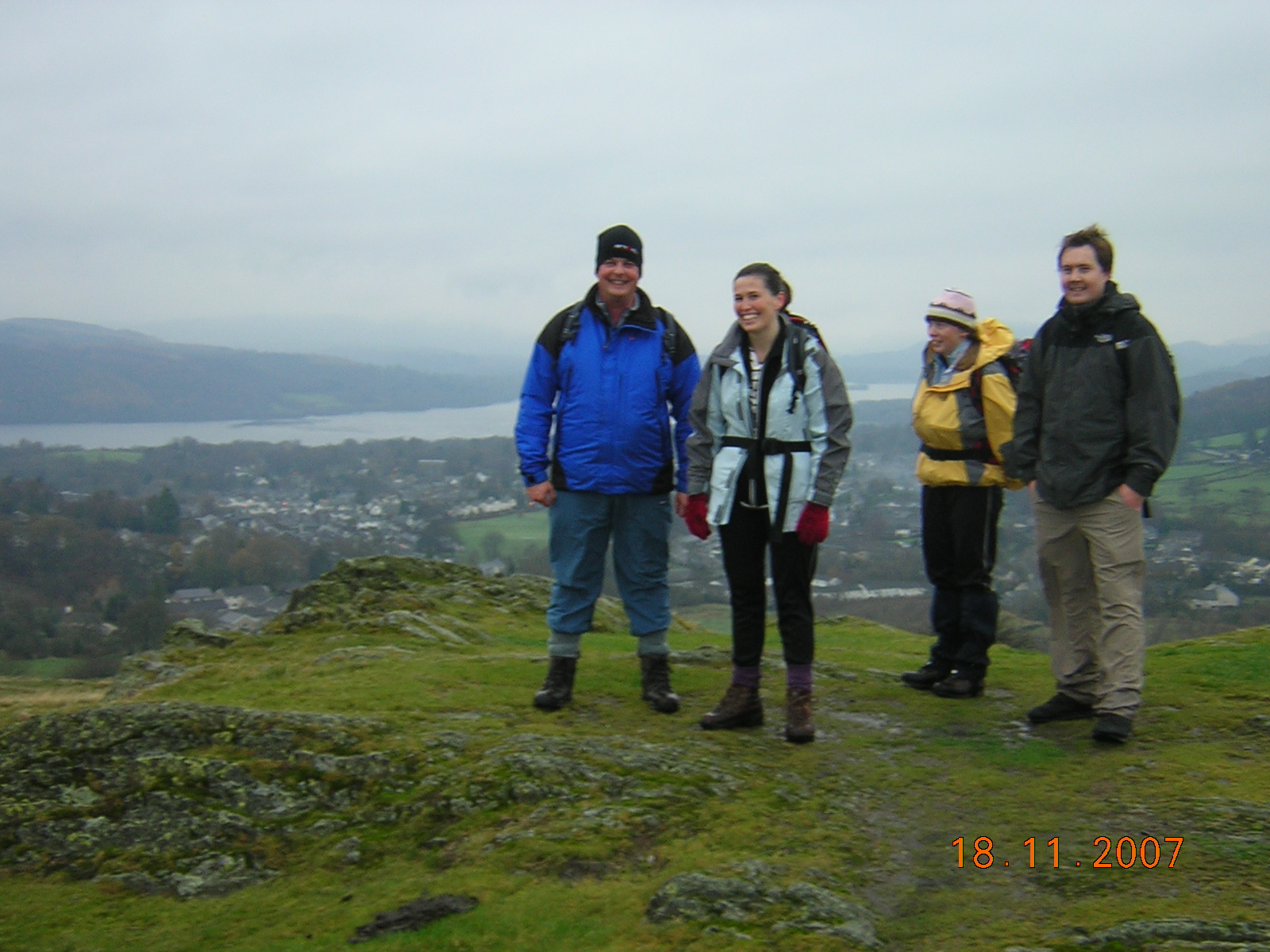
Walk for Sunday 18th November - 3 Peaks of Windermere
Walk for Sunday 18th November
Leader Simon 07791 006 232
The three peaks of Windermere
A pleasant autumn walk enjoying woodland, field paths, winding lanes and three low summits surrounding Windermere and Bowness.
The route takes in Elleray Wood, Orrest head, Ings, School Knott, part of the
Start point / time 11am. Birthwaite road, Windermere village, gr 412 983
(off main "a" road opposite the Ellerthwaite lodge hotel just south of shops).
Car share possible at Morisons Ccarpark, Kendal at 10,30 am
Distance 5.5 miles
Time : 4 to 6 hours pub lunch optional at Ings, tea rooms in Bowness and a chance to buy discounted goods at Stuart Sports in Bowness.
Ascent - approx 350 mt
Grade 1 easy
Sunday, 11 November 2007


Walk for Sunday 11th November - Potter Fell from Bowland Bridge
11TH NOVEMBER
POTTER FELL FROM BOWLAND BRIDGE
LEADER JAMES 0777 993 6378
Sunday, 4 November 2007
Walk for Sunday 4th November - Dunnerdale Fells, Duddon Valley
Walk for Sunday 4th November – Dunnerdale Fells, Duddon Valley
A walk over the peaceful Dunnderdale Fells on the edge of the Duddon Valley. Starting at Broughton Mills it takes in the pint-sized, but nevertheless perfectly formed, Great Stickle, Stickle Pike and Caw, and returns via the Lickle Valley.
Distance: 7.5 miles
Time: 5-6 hours
Start: The bridge at Broughton Mills @ 10am Grid Reference: SD 222 908
Car Share: Morrisons car park, Kendal @ 9am
Contact: Jeremy 07899 923019
Sunday, 28 October 2007
Walk for Sunday 28th October - Glaramara / Allen Crags / Sty Head / Borrowdale
28TH OCTOBER
Glaramara / Allen Crags / Sty Head / Borrowdale
Start Point: Seatoller car park
(G.R. NY - 245 137 @ 10.30)
Description: From Seatoller we head up onto Thornythwaite Fell, before climbing more to reach the summit of Glaramara (which one of the two cairns??). We'll then continue SW, between the bogs & pools for another 2km, until Allen Crags rocky 'cluster' is reached (highest point of the day, just!). We carry on just a short way until we reach the spaghetti junction of paths at Esk Hause (this is because it's a joining point for paths from Eskdale, Wasdale, Borrowdale & Langdale!). There is a big stone cross windbreak here, so it may be a possible lunch stop location? After that we turn NW to pass under the cliffs of Great End, past Sprinkling Tarn & down to Styhead Tarn. Next we turn NE by the tarn, to follow Styhead Gill (on its RHS when the path splits) down to cross Stockley Bridge. We then follow the 'growing' river down to Seathwaite (coincidentally - this is said to be the wettest inhabited place in England!!) & follow the obvious (virtually flat) path, // to the road, back along Borrowdale to Seatoller once more.
Distance: 9.5 miles (15.3 km)
Total Ascent: 800 metres (2625 ft.)
High Point: Allen Crags - 785 metres (2575 ft.)
Time: 6 - 7 hours
Grade: 3 / 4
Car Share: Meet at the Low Wood Hotel @ 09.00
Leader: Dan (on 01229 832840 [eves.] or 07919 831237)
Friday, 26 October 2007
SuMMitt Good Social - Friday 26th October
Friday 26th October and every last Friday of the month
Meet at the brewery arts centre, vats bar in Kendal
From 8pm
A chance for new members to meet existing members
If you are new and don't know anybody in the group call me first
Rob 0777 398 6512
Sunday, 21 October 2007
Walk for Sunday 21st October - Mitredale, Scafell and Wastwater
21st October - Mitredale, Scafell and Wastwater
22km, 1200m.
Meet in the car park at Mitredale (Eskdale), grid ref146012,
at 9am. We walk up Mitredale to Burnmoor Tarn, then onto Scafell via Hardrigg Gill. Descent to Wasdale down the E flank of Scafell, then along the SE shore of Wastwater to Easthwaite. Back to the starting point by bridleway through forests. This is a tough walk with lots of ascent, and the path along the shore of Wastwater is very rough. Bring lots of food and headtorches please!
Jane 07733 22 82 02
Sunday, 14 October 2007
Sunday, 7 October 2007
Walk for Sunday 7th October - Wythburn Wanderer and Steele Fell
Start Point: Dob Gill Car Park - about 1km from the S. end of Thirlmere
(G.R. NY 316140) @ 09.30
Description:
Dob Gill / Wythburn Fells / Ullscarf / High Raise / Sergeant Man / Grasmere Common & Steel Fell
Distance: 10 miles (16 km)
Total Ascent: 875 metres (2870 ft.)
High Point: High Raise - 762 metres (2500 ft.)
Time: 7 / 8 hours
Grade: 4
Car Share: Meet at the Low Wood Hotel at 09:00
Leader: Dan (on 01229 832840 [eves.] or 07919 831237)
Route Details:
- from c.p. head SW on S side of Dob Gill
- by Harrop Tarn turn SE onto Birk Crag
- S, SW, then W to cross Wythburn Fells & ascend Ullscarf
- S & SSW up High Raise
- SE to Sergeant Man
- NNE over Codale Head
- N down Mere Beck
- E to Calf Crag
- NE & E to Steel Fell
- Down N ridge to Wythburn
Sunday, 30 September 2007


Walk for Sunday 30th September - 4 Passes/3 Valleys
8.30 AM Meet at the Low Wood Hotel Near Ambleside for Car Share
9.30 AM Meet in Seatoller National Trust Car Park Borrowdale GR 244138
Grade 4
Time 8 Hours
Total Ascent 1500 Metres Approx
Distance 18km
Although this is a long walk it is fairly easy as the ascent is spread out during the day.
We start at Seatoller following the coast to coast path to Honister Pass, on to Haystacks, down Scarth Gap Pass to Ennerdale passing Black Sail Hut Youth Hostel, up Black Sail Pass, down into wasdale head for a quick liquid refreshment, we then make our way up to sty head pass the last incline of the day then returning to cars via Seathwaite Valley.
We did this walk 3 years ago and every one thoroughly enjoyed it
Highly recommended
Leader Rob 0777 398 6512
Friday, 28 September 2007
SuMMitt Good Social - Friday 28th September
Friday 28th September and every last Friday of the month
Meet at the brewery arts centre, vats bar in Kendal
From 8pm
A chance for new members to meet existing members
If you are new and don't know anybody in the group call me first
Rob 0777 398 6512
Sunday, 23 September 2007
Walk for Sunday 23rd September - Scafell via Corridor Route
Sunday 23 September 2007
Scafell Pike via Corridor Route
Seathwaite (Borrowdale) - Stockley Bridge - Sty Head - Lingmell (via Corridor Route) - Scafell Pike - Great End - Esk Hause - Grains Gill - Stockley Bridge - Seathwaite
Total distance 9.0 miles (equivalent distance approx. 16 miles)
Total ascent 3,600 feet
Start point: Seathwaite farm, Grid ref. NY 236122
Start time: 10.00am, meet at Low Wood at 09.00am for car sharing
Brief description:
This route is recommended by Wainwright and is said to be the most scenic way to ascend Scafell Pike. It takes us up the main valley path to Stockley Bridge and on to Styhead Tarn. The onward path by the Corridor Route is amazing. On a clear day, we should enjoy some great mountain scenery, including views of Great Gable, Kirk Fell, Pillar and Red Pike (Wasdale). Aiming for Lingmell Col, we cross a number of ravines, of which Piers Gill is the most spectacular.
This is a reasonably long walk. In theory the fell can be tackled by anyone with some experience and a good level of fitness.
Just give us a shout if you'd like me to add / delete anything!
All the best,
Anne
LEADER ANNE 07729 903 852
Sunday, 16 September 2007
Walk for Sunday 16th September - Gatescarth and Kentmere
'Pass Fest !' (Gatescarth, Nan Bield & Stile End B.O.A.T.)
Sunday th
Start Point: Sadgill Farm, Longsleddale
(G.R. - NY 483 057 @ 09.45)
Description: At the end of the tarmac (by Sadgill Farm [195m / 640ft.]) we first head N up Longsleddale, 'avoiding' the Mosedale turnoff, to reach the Gatescarth Pass. From the top (590m / 1935ft.) we descend NW down towards Haweswater. Before reaching the car park we turn WSW (260m / 853ft.) to climb past Small Water, before veering S up onto the Nan Bield Pass. Once at the shelter on the top (630m / 2067ft.), rather than continuing down into the Kentmere Valley, we turn E & then SE to climb Harter Fell (778m / 2552ft.). Next we follow the ridge S & then SE to climb Kentmere Pike (730m / 2395ft.) then continue towards Goat Scar. The path then drops steeply S, over Shipman Knott (587m / 1925ft.) down to the Stile End Farm B.O.A.T. From there it's just a case of following the B.O.A.T. E & then N, past Sadgill Wood, back to Sadgill Farm.
Distance: 11 miles (17.7 km)
Total Ascent: 1067m (3500ft.)
High Point: Harter Fell - 778 m (2552ft.)
Time: 6 / 7 hours
Grade: 4
Car Share: Meet at the Low Wood Hotel @ 09.00
Leader: Dan (on 01229 832840 [eves.] or 07919 831237)
Sunday, 9 September 2007
Walk for Sunday 9th September - Keswick
Keswick – Theatre by the Lake, Castle Head, Walla Crag, Ashness Bridge, along Derwent Water back to Keswick.
Starting Point – outside Theatre by the Lake at 10.30am
Parking – Lakeside Car Park (unfortunately you will have to pay)
Distance – 6.5 miles
Ascent – 1,083ft (330m)
High Point – Walla Crag (1,234ft)
Time – 3 hours
Grade - 2
Leader - Sam B (07890 961 482)
Additional information;
Starting Point – outside Theatre by the Lake at 10.30am
Parking – Lakeside Car Park (unfortunately you will have to pay)
Distance – 6.5 miles
Ascent – 1,083ft (330m)
High Point – Walla Crag (1,234ft)
Time – 3 hours
Grade - 2
Leader - Sam B (07890 961 482)
Additional information;
Starting Point - Theatre by the Lake @ 10.30am (Grid Ref: NY 265229)
Distance is actually 7 miles and will take 4 hours.
Starts with a walk through Cockshot Wood (opposite landing stages at Derwent Bay), cross the Borrowdale Road and gentle ascent through Castlehead Wood up to Castle Head. Descend to Springs Road and on through Springs Wood. Steeper assent up to Lady's Rake and up to Walla Crag. Traverse the head of Cat Gill and descend past Great Wood to Ashness Bridge. Return with an gentle walk through Great Wood and along the lake back to Derwent Bay.
SamSunday, 2 September 2007
Walk for Sunday 2nd September - Coniston and Seathwaite
Description: Ascent of Consiton Old Man and Dow Crag from the less frequently visited Dunnerdale side, avoiding the old quarries on the standard route.
Route: From the start point, we head up to Seathwaite Tarn, then on to Goat's Hawse. We then take in the summits of Brim Fell, Coniston Old Man, Dow Crag, Buck Pike and Brown Crag, before returning via the Walna Scar Road, followed by refreshments in the Newfield Inn in Seathwaite.
Grade: 3
Distance: 14 km (9 miles)
Total Ascent: Approx 800 m
Time: 5-6 hours
Start: 10.30 Lay-by to the East of the Dunnerdale road, approx 1 mile north of the Newfield Inn, Seathwaite. Grid reference SD230974. Click here for a map.
Leader: Tom 07884493081
Friday, 31 August 2007
SuMMit Good Social - Friday 31st August
Friday 31st August and every last Friday of the month
Meet at the brewery arts centre, vats bar in Kendal
From 8pm
A chance for new members to meet existing members
If you are new and don't know anybody in the group call me first
Rob 0777 398 6512
Monday, 27 August 2007
.JPG)
Sunday, 26 August 2007
Walk for Sunday 26th August - Scafell Pike from Wrynose & Wild Camp
26TH AUGUST
ALSO WILD
LEADER JAMES 07779 936 378
DETAILS BELOW FOR WILD CAMP ON SATURDAY NIGHT 25TH AUG
Go over Hard Knot Pass and meet at phone box at bottom of Hard Knot Pass around 4.30pm to 5.pm Saturday (car park on left). GR: 211 012
Follow path up Esk - at fork in streem turn left over stone bridge and coninue to follow steem up. We will be camping under Scar laithing Were the vally levels off. - look for big flat table size rock. GR:224 048
Walk on Sunday: Scarfell Pike. Meet at Scar lathing (as above) arround 10.00am. Through upper Eskdale and then up Broadstand to Scarfell Pike.
Tea at Woolpack?
Contact James on: 0777 993 6378
Sunday, 19 August 2007
Walk for Sunday 19th August - Ladyside Pike, Hopegill Head, Grisedale Pike
Ladyside Pike, Hopegill Head, Grisedale Pike
Meet at NY 191245 at the parking area on Whinlatter Pass (free parking) at 10.30am
Low Wood at 9.30am
The walk begins walking along the forest tracks on Whinlatter Pass and then we head off up a steep but short path onto the shoulder of Ladyside Pike. After ascending Ladyside Pike we then head off up a rocky path to the summit of Hopegill Head, along to Grisedale Pike and then descend via Hocarton. The track is fairly muddy as we ascend back to the forest track leading back to the parking area. There are good views across the Crummock and Derwent Valleys.
Time about 4 to 5 hours
Distance about 4 to 5 miles
Total ascent about 600m
Grade 3/4
Leader Malcolm 07717 48 77 55
Sunday, 12 August 2007
Walk for Sunday 12th August Ennerdale and Steeple Circuit
Ennerdale & Steeple Circuit
Start Point: Forestry Commision car park @ the W. end of Ennerdale Water
(GR – NY 085154 @ 09.00am)
Description: The first third (or so) of this walk is a gentle wander alongside Ennerdale Water. After heading E. from the E. end of the lake for about another mile & a half we turn S. and head, steeply, up to the top of Steeple (819 m). Next we head SW then NW along the ridge, taking in Scoat Fell, Haycock, Caw Fell, Iron Crag, Crag Fell and Grike before descending back to the car park.
Distance: 13.75 miles (22 km)
Total Ascent: 1150 metres (3773 ft.)
Time: 8 / 9 hours
Grade: 4
Car Share: Meet at the Low Wood Hotel @ 08.00am
Leader: Dan (on 01229 832840 [eves.] or 07919 831237)
Sunday, 5 August 2007
Walk for Sunday 5th August Buttermere Horseshoe
BUTTERMERE HORSESHOE
LEADER ANNE KEY 07729 903 852
WALK FOR 5TH AUGUST
BUTTERMERE HORSESHOE
This is a long and strenuous walk that presents little technical difficulty. I plan to incorporate plenty of rest stops to enjoy the views / take a breather. Depending on weather conditions on the day, it may be necessary to shorten the walk.
Please bring plenty of waterproof, warm clothing and food/drink in case the weather doesn't cooperate!
From the National Trust car park at the village of Buttermere (GR 173172), we commence on a long, gradual ascent of Red Pike via Scale Force. Views open up across Crummock Water, taking in Grasmoor, Robinson and other fells.
From Red Pike, we follow the main path along the ridge, taking in High Stile, High Crag and Seat until we arrive at the path junction at Scarth Gap.
The main route continues from Scarth Gap to take in the twin summits of Haystacks. From Haystacks, the path descends past Innominate Tarn, where fine views can be had of Great Gable and Green Gable (and the remains of A.W. Wainwright).
If we all happen to be in a masochistic mood (and if the weather's cooperating), we may detour to take in the spectacular views from Fleetwith Pike. If we're in a less masochistic mood, we will head down to the road at Honister Hause via Brandreth and Grey Knotts.
The route back to Buttermere Village (and a much-needed drink (or drinks!)) is then reasonably straightforward, traversing the rough open moorland of High Snockrigg.
Start: National Trust car park, Buttermere Village, GR 173172
Start time: 09.30 AM, 08.30 AM from Low Wood Hotel for car sharing*
Length: 14-16 miles
Ascent: 5,800 feet / 1,758 metres
Time: 8 hours
Grade: Very hard
* note the earlier start time, hopefully there should still be plenty of parking available at this time
note; I recently did a reccie of the planned route, and have amended the walk slightly.
The inclusion of Brandreth and Grey Knotts would increase the length of the walk. It therefore seems to make most sense to head straight down down to Honister Hause from Haystacks.
It will be possible to stop off at Honister Slate Mine for a coffee / tea break, before heading up Dale Head.
The total length of the walk is 15 miles, and will take approx. 9 hours to complete (including rest stops). I am happy to shorten the walk if need be.
Start: National Trust car park, Buttermere Village, GR 173172
Start time: 09.30 AM, 08.30 AM from Low Wood Hotel for car sharing*
Length: 14-16 miles
Ascent: 5,800 feet / 1,758 metres
Time: 9 hours
Grade: Very hard / strenuous
* note the earlier start time, hopefully there should still be plenty of parking available at this time.
see comments from Anne in 'ramblings on' below for the walk description
Subscribe to:
Comments (Atom)